 |
|---|
| Photo credits |
|
|---|
| Photo credits |
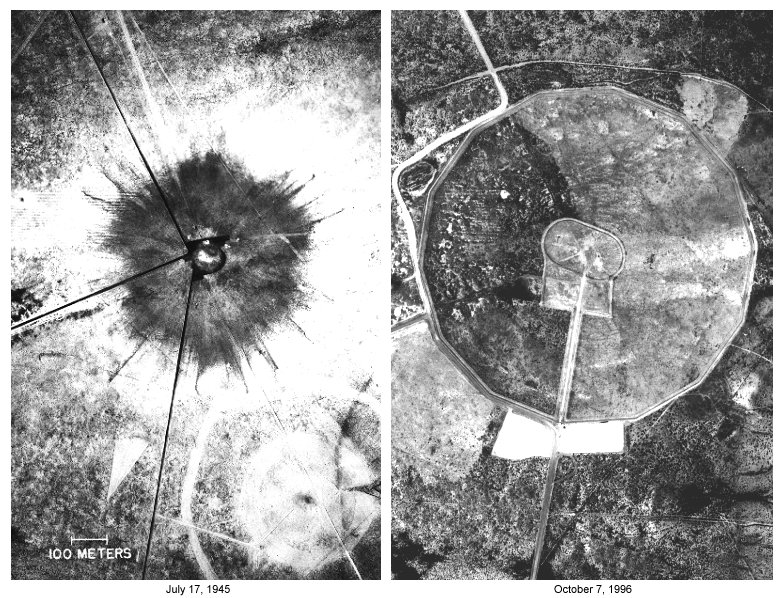
This section contains three pairs of images of the Trinity Site at the time of the test compared to the way it looks today. The above two photos are aerial views of the site. The photo on the left was taken about 28 hours after the explosion. Visible are the large expanse of Trinitite produced when the desert sand was fused into glass, the remains of the tower footings at ground zero, a small crater produced by a 100 ton test with conventional explosives (in the center of the light colored circle), and Jumbo. The photo on the right was taken in 1996. The two perimeter fences are the main features visible in this photo. The outside fence is about 1/2 mile in diameter. The inside, racetrack shaped fence encloses ground-zero. The monument is barely visible as a black dot at the center of the right hand semi-circular part of the fence. A building protecting a portion of the original crater is located near the center of the left hand semi-circle. At the bottom is the parking lot for visitors. The small black spot at the top center of the parking lot is Jumbo and the short black "line" at the upper left of the parking lot is the line of Port-a-potties (this photo was taken two days after the second open house in 1996). The road at the bottom of the photo leads to the McDonald ranch house.
 |
|---|
| Photo credits |
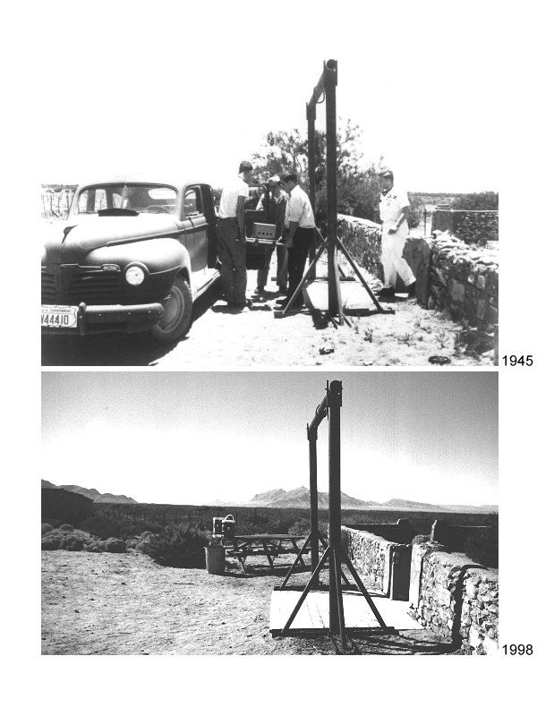
The next pair of images is related to a famous photo of the Plutonium core being transported from the McDonald ranch house to the shot tower. The house and surroundings have been restored nicely. The barn outside this image to the left is missing its roof which collapsed due to the explosion.
 |
|---|
| Photo credits |
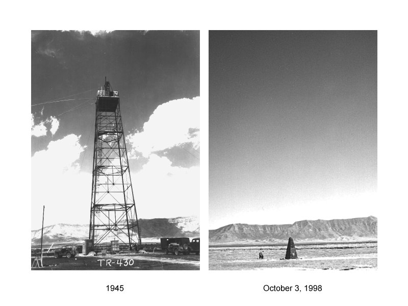
The final pair of images shows the shot tower as it appeared shortly before the test compared to the area today. The bomb was mounted in the shed at the top of the tower 100 feet above the ground. Today, the lava-stone monument stands directly below where the bomb was detonated. Remains of two of the shot tower's footings can also be seen today. Part of the left front (Northwest) leg in the 1945 photo still pokes above the ground and is surrounded by a simple rail made of reinforcing rod. It is barely visible in the 1998 photo. The right front (Southwest) footing in the 1945 photo is also visible today almost directly in front of the monument. Note the difference in elevation of the footings between the two photos. The concrete was badly damaged by the explosion, reducing the height of the footings slightly. More significantly, the footings were shoved 5-7' into the ground by the explosion3. Assuming the camera in 1945 was at the same height as for the 1998 photos, the offset between the two photos may be indicative of these changes.
| Return to Home Page | Latest update: December 12, 1998 |