 |
|---|
| Ground Zero Monument |
|
|---|
| Ground Zero Monument |
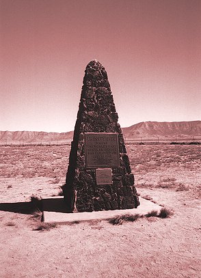
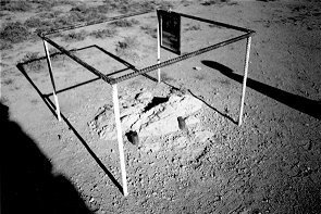
Ground zero at the Trinity Site is marked by a monument made of lava rocks. The bomb was exploded on the top of a tower 100 feet above this point. The stone for the monument probably came from the western most local lava flow seen in the following image from a U.S. reconnaissance satellite.
|
|---|
| Volcanism Near Trinity Site |
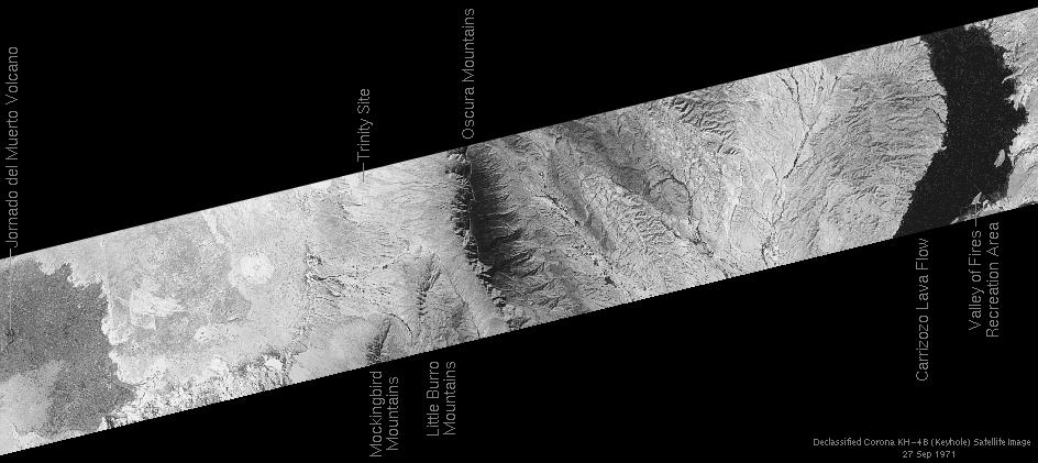
Two lava flows are seen near the edges of the image. The Jornada del Muerto volcano on the left erupted about 760,000 years ago. Small vents in the Earth's crust produced the Carrizozo lava flow (seen at the right) about 1000 years ago.
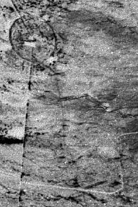
Trinity Site itself is barely visible in the photo. An enlarged and enhanced portion of the photo around the site is shown below.
|
|---|
| Trinity Site Satellite Image |
The above photos were taken by a United States KH-4B reconnaissance satellite on September 27, 1971 as part of the CORONA satellite program. In 1995, images from the CORONA, ARGON and LANYARD programs were declassified by Executive Order. The photos have been made available by the US Geological Survey's Global Land Information System. The image here is from mission 1115-2 on revolution 274D, frame 7 from the forward camera.
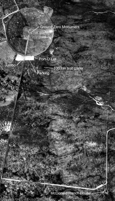
A much better aerial view of the site is seen in the following photograph made from a high altitude aircraft.
|
|---|
| Trinity site area |
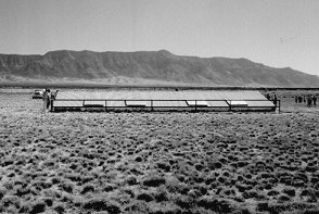
This aerial view taken October 7, 1996 shows the Trinity Site area as it appears today. The fenced ground zero area is at the top of the photo. There is a roughly circular outer perimiter fence about 1/4 mile from ground zero and a second oval fence closer in. The parking lot is located at the south edge of the outer fence. This is the location of Jumbo, the 214 ton canister originally intended to house the bomb during the test. Had a nuclear reaction not occurred, Jumbo was designed to contain the blast from the high explosive charge. This would have prevented about a quarter of a billion dollars worth of Plutonium from being scattered across the countryside. If a nuclear reaction did occur, Jumbo would have been vaporized. Before the test it was decided Jumbo wasn't needed and would affect the data so it wasn't used.
At the bottom of the photo is the McDonald ranch house, about 2 miles from ground zero. This is where the Plutonium core was assembled before being inserted into the bomb. The explosion caused the roof to bow inward. This has since been fixed. The roof of the adjacent barn was totally collapsed and is still missing.
 |
 |
|---|---|
| Outer fence warning | Inner fence warning |
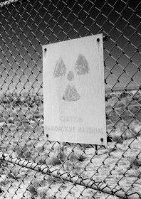
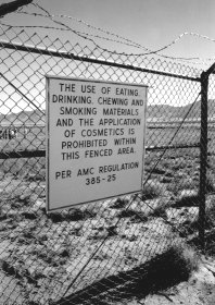
Radiation levels at the Trinity Site still run more than 20 times the normal background level in some spots. These signs were found on the perimeter fences described in the aerial photo. According to the official Trinity web site the inner fence warning was removed the year after this photo was taken.
 |
 |
|---|---|
| Fat Man Type Bomb Casing | Crater Shelter |
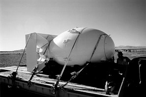
The left hand photo above shows a "Fat Man" type bomb casing. A duplicate of the bomb exploded at the Trinity Site was installed in a casing like this one and dropped on Nagasaki. Apparently quite a few of these casings were made. Many were used for practice drops and some were dropped on Japan containing conventional explosives.
The right hand image is a low tin shed that preserves part of the original crater. In the 1950's, the Army bulldozed most of the Trinitite from the site and partially filled the crater with dirt in an effort to reduce the radiation levels. The ground in this shelter has had less manipulation than the rest of the crater. Substantial amounts of Trinitite can still be seen through an opening on the other side.
 |
 |
|---|---|
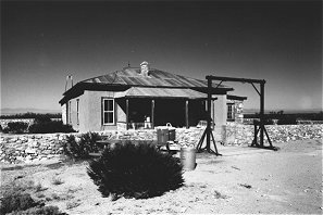
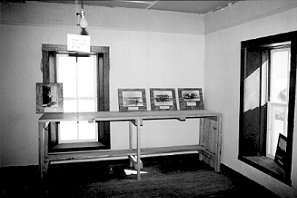
| McDonald Ranch House | Plutonium Core Assembly Room |
The next two images give a brief glimpse of the McDonald ranch house. An extensive restoration has been done to bring the house back to the way it looked in 1945. Even instructions written on the door in chalk have been reproduced. The right hand image is found through the front door and fills the right front corner of the house. This is where final assembly of the Plutonium core for the bomb took place. Trinity Site is out the window at the left of the picture.
 |
 |
|---|---|
| Northwest Footing Remains | Southwest Footing Remains |
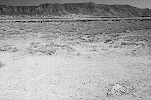
The most significant items to survive the explosion were the reinforced concrete footings the shot tower was mounted on. Two are easily visible and are shown in these pictures. At the expected location of the Northeast footing, a roughly 3 inch piece of reinforcing rod can be seen barely protruding from the ground. This may be a piece of the Northeast footing or something left over from later construction at the site.
The footings do not appear as they did right after the explosion. Based on 1945 photos2 it appears the exposed reinforcing rods have been cut back closer to the concrete. After the explosions, the Northwest and Southwest footings were partially excavated to study the damage to them and they may have been altered at this time.
| Return to Home Page | Latest update: November 3, 2003 |